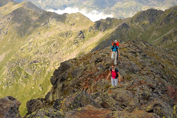
Andorra hiking Guide
Andorra hiking Guide
Hiking in Andorra: foreword
Andorra is advertised as the “country of the Pyrenees”, which makes sense because it is an extremely mountainous country – though none of its summits reach 3000m. France is to its north and east; Catalonia (Spain) to its west and south.
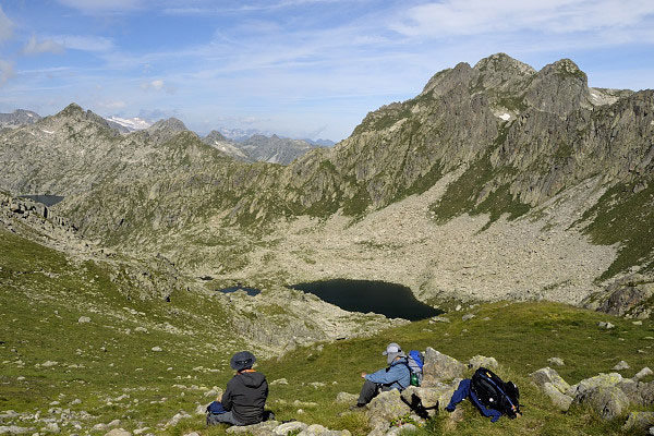
Andorra is only 464 square kilometres. The shape of the land has been modelled by glaciers for centuries. Now rivers and ravines run along the bases of the U-shaped valleys. After the glaciers disappeared they left behind 80 lakes in the mountains, and these are one of Andorra’s main attractions.
Andorra hiking Map
This map shows
> my personal version of the GRP trail (red and blue)
> the Pessons and Colells cirques trail (violet)
> the Madriu-Perafita-Claror valley Natural Park (coloured surface)
> the three peaks described (stars)
> the staffed mountain huts in Andorra
I have not outlined the other protected nature areas because they are contained in the base of the map. Please, zoom in to see the details.
Protected nature areas you can visit hiking in Andorra
Valls de Comapedrosa Natural Park
Everyone wanting to hike in Andorra must visit this park, which is located in the North-West of Andorra (1542 hectares). The highest peak in Andorra is in the park. There are 9 trails of different levels that have been signposted.
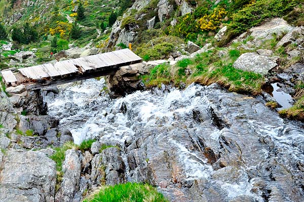
The highlights of the park are the waterfalls, high mountain landscapes and lakes, and the springs.
More information here, though it’s only in Catalan
One of the staffed mountain huts in Andorra is in the park.
Sorteny valley Natural Park
The Sorteny valley, situated in the North of Andorra, is well known for its beauty and flora. It is the park I love most, although it is very small, only 1080 hectares.
780 different species of flora grow in the park, 50 of which are endemic in the Pyrenees. Some easy botanical paths have been signposted and there is also a botanical garden. More information about this garden and the staffed mountain hut in the Estanyó peak ascent section of this article.
June is the preferred month to visit the park.
Information about the itineraries and flora in the park here, though it’s only in Catalan.
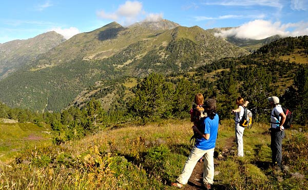
Sorteny valley. On the way to Estanyo peak
Madriu-Perafita-Claror valley Natural Park
It is the largest park in Andorra (4247 hectares) and was declared World Heritage by UNESCO.
This park is located in the South-East of Andorra, and is the only long valley in Andorra with no roads or tracks for 4WD vehicles. The highlights of this park are the solitude and quietness. The shepherd shelters are worth a visit.
There are many shelters in the park that could be very useful in case of very bad weather.
My preferred season to visit the park is autumn, October, because the woods are reddish and yellowish coloured and contrast with the green of the evergreen conifers. Also, the blue sky strongly contrast with the pale grey granitic rocks.
More information here.
Peaks hiking Andorra
Andorra has 36 peaks above 2800m, 43 between 2700 and 2800m, and 23 between 2500 and 2700. Most of the peaks can be climbed without using a rope between late June and late October.
However, in summer, some peaks may need a rope either to reach the summit or to descend:
- Escobes peak
- Cilindre d’Escobes peak
- Roca Entravessada peak
- North-west crest line of the Cataperdís peak
- Estany blau peak
- North side of Casamanya peak
- Crest line between la Serrera peak and Coma de Varilles peak
- Alt del Juclar peak
- Rulhe peak
- The descent from Tossa del Juclar to Juclar lakes
- The crest line of l’Aliga peak
- The crest line of les Àgols peak
- Forat dels Malshiverns crest line
Attention! Be careful in September. Dozens of hunters go around hunting chamois.
You can find below peaks and valleys that stand out for various reasons while hiking in Andorra.
Enchanting peaks
Rulhe peak: it is situated in Occitania, next to the border with Andorra. Infinite views from the summit. Isolated peak located in a wild area of the Pyrenees.
Thoumasset peak, also in Occitania. A half-day hike.
Solitude
Cabaneta peaks.
Siscar valley
Ensangents cirque and lakes
View points
Medecorba peak (snow patches remain until late July)
Saloria peak, in the Catalonian Pyrenees but next to Andorra
Font Blanca peak
Perafita peak
Tossa del Braibal
Envalira peak
Alt del Griu
Tossa Plana de Lles
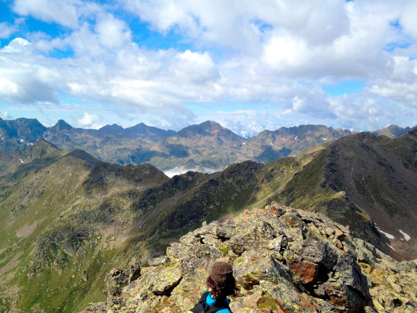
Awesome views
Beauty
Incles valley
Escobes peak. Bird’s-eye views. Solitude. Amazing path to the summit. You pass by the Juclar lakes.
Tossa de Juclar peak
Fontnegra peaks, situated out of Andorra but next to the border
Angonella lakes
Pessons peak
Madriu valley. More information in Protected Nature Areas in Andorra.
Andorra can be summed up by leaving behind noise from crowds and cars to finding complete solitude within several minutes.
Below I will describe the ascents to three peaks: Tristaina, Coma Pedrosa and Estanyo. I must say that it has not been easy to choose three peaks out of 102.
Coma Pedrosa peak (2942m)
Also spelled ‘Comapedrosa’, it is the highest peak in Andorra so, in summer, it is a bit crowded. There are two things worth noting: the views from the summit, and the elevation gain of 1400m.
If you make the hike shorter, I advise you to stay overnight at the Comapedrosa mountain hut (2267m) the night before. Staff at the hut prepare dinner, breakfast and packed lunches.
When to go? From late spring until late October. The rivers carry a lot of water and there are still some snow patches starting at 2400m. So crampons and ice axe are advisable if you climb before mid-July.
You start at Arinsal ski resort (1467m) and follow the GR11 trail, pass by the Comapedrosa hut and leave the GR11 at Estany Negre lake (2591m). From there, you reach the summit following the south-west crest line.
From the summit there are excellent views of Pica d’Estats (3140m), the highest peak in the Catalan Pyrenees, and Carlit, in France, the highest peak in La Cerdanya.
If you do stay overnight at the Comapedrosa hut, the following itinerary allows you to reach three more peaks, and views over the Vallferrera valley and Monteixo range:
> descend to Forat dels Malshiverns (2826m),
> reach the Baiau peak (2885m)
> descend to Baiau pass (2756m), where you will find the GR11
> scramble to the Agulla de Baiau peak (2859m). Pay attention! Loose rocks
> go to the either summit of the Sanfons peak (2886m)
> follow the crest line between Andorra and Catalonia to Portella de Sanfons pass (2588m)
> walk a signposted path which descends to Truites lake and then Comapedrosa hut
Wonderful circular route! Not to be missed!
Tristaina peak (2882m)
Climbing Tristaina peak is now a half-day hike, or nearly, thanks to the road which goes to Vallnord-Arcalís ski resort. This peak is situated between France and Spain, in the North of Andorra.
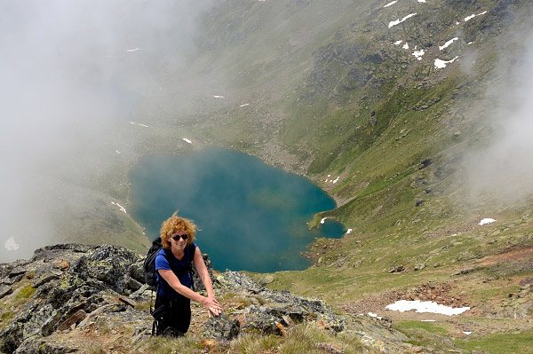
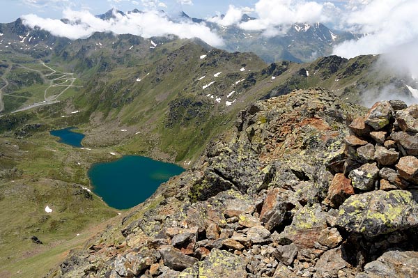
Tristaina is one of the peaks I love most for several reasons. The hike takes you past three beautiful lakes, the Tristaina lakes, situated on terraces, each at a different altitude. The summit is small, with bird’s-eye views; the peak is slim and beautiful, easily recognised from the south.
Tristaina lakes are ideal for those looking for gentle hiking in Andorra.
When to go? From late June until late October.
You should park your car beside the road in a small parking area before La Coma restaurant. There is a signpost which informs that you are on the HRP (Haute Route Pyrénéenne, in French), a signposted trail which crosses the Pyrenees, similar to the GR11 and GR10.
You should follow the HRP marks to the highest Tristaina lake. There, you turn left and head to the pass situated on the left of the summit. Steep slopes before the pass with some screes! Once at the pass, turn right and follow the crest line to the summit. This crest line runs between France and Andorra.
From there, excellent views over the lakes in France, with Forcat lake the biggest. Also infinite views to the East, South and West. Usually the French side is covered by clouds.
You can either come back on the same path, or:
> Follow the west crest line to the Petit de l’Estany Forcat peak, also called Costa Rodona peak (2821m)
> Follow the crest line to the South to the Port de Tristaina pass (2636m)
> Then walk down a path to the first Tristaina lake.
One of my best memories of this peak is the view of the Forcat lake, in France, above the clouds nearly always present in the French side of the Pyrenees.
We climb Tristaina peak in our 4-peak long weekend tour in Andorra.
Estanyo peak (2915m)
Estanyó peak is known as the view point of Andorra because it is above 2900m, and located far from the Andorra borders.
One of the highlights of this ascent is the Sorteny Valley. There are only three nature reserves in Andorra, and Sorteny valley is one. The diversity of flora is worth a visit. On the way up you can visit the small Botanic Garden, where you can see the main flowers of this mountain. It will take 15 minutes.
How to get there? Best to drive to the car park not far from the Sorteny staffed mountain hut, though you need a 4WD vehicle.
When to go? From Early July until late October.
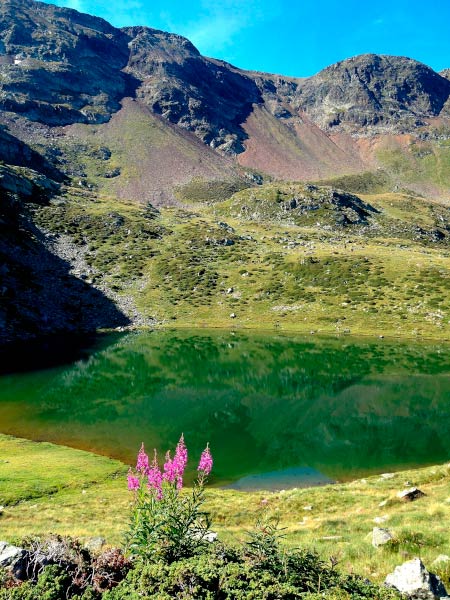
Once in the car park, follow a path that is barely marked. The path follows the Estanyó river valley. Eventually you reach the Estanyó lake (2399m), a beautiful lake surrounded by mountains. It’s a peaceful place. In early summer you will see hundreds of different flowers.
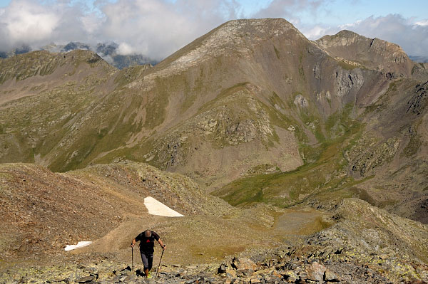
Turn left and walk up the crest line of the Roca del Rellotge range. The path is marked with cairns. Follow the crest line to the summit. From there you can overlook Andorra in all directions. If the weather is good, it’s worth staying there for a while to enjoy the views.
To come back, follow this itinerary:
> Follow an easy and wide crest line to La Cabaneta peak (2863m).
> Continue north along another crest line, until you reach Cap de la Serrera peak (2724m). Pay attention here! The path crosses steep scree and sometimes is not easy to follow. Some points are a bit exposed.
> Eventually you get to the Meners pass (2713m), where you find the HRP trail.
> Follow left the HRP to the Sorteny mountain hut. This descent is the perfect end to a challenging though amazing hike.
We climb Estanyo peak in our 4-peak long weekend tour in Andorra.
Trekkings and long trails hiking Andorra
It is not easy to create treks in Andorra because there are few villages out of the bottom of the valleys and only four staffed mountain huts.
However, Andorra has many unstaffed mountain huts that are useful in case of very bad weather.
My advice is to stay overnight at hotels, hostels and staffed mountain huts.
GR11 trail
This long trail which links the Mediterranean Sea with the Cantabrian Sea crosses Andorra. More information at this article, legs 11th and 12th.
4-peak long weekend tour
We have designed this 4-day tour for you. To find out more, take a look here.
GRP trail – Hiking in Andorra for five-seven days
This long trail goes around Andorra and is 107km long. It has been designed to be walked in 7-8 days, but the part explained below covers 5 legs. If you want to walk all the path you should stay overnight at the Claror unstaffed mountain hut. Nevertheless, there is a way to avoid the Claror mountain hut. See below after the 5th leg.
1st leg: Hotel Peretol (Envalira) – Juclar mountain hut
784m elevation gain – 8.2km
You pass by the Siscaró lakes, situated in a small cirque at 2300m. You can stay there for a while to breath in the solitude.
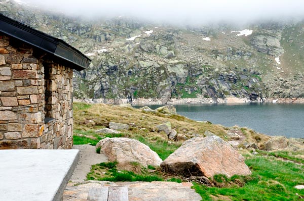
Eventually you reach the Juclar staffed mountain hut, where you will stay overnight. This inn is located next to the biggest lake in Andorra, the Estany Primer de Juclar lake.
The hut is surrounded by popular peaks, such as, Siscaró peak, Escobes peak. They are reachable after short hikes.
2nd leg: Juclar mountain hut –Sorteny mountain hut
1341m elevation gain – 17.3km
Undoubtedly the hardest leg of this trek (you walk up and down like a roller coaster) but also the most interesting.
After leaving the Incles valley, you land in the Ransol valley. You always walk between 2200 and 2500m so the path is a continuous view point of Andorra.
The last ascent takes you to the Meners pass, where we enter the Sorteny Natural Park. Then, you walk down the Sorteny valley to the Sorteny mountain hut, following a path surrounded by thousands of flowers in late spring and summer. More information about this descent in the Estanyó peak part of this article.
3rd leg: Sorteny mountain hut – Llorts
39m elevation gain – 7.2km
This is a transition leg that permits you to rest after the long hike of the previous day.
You stay overnight at the ApartHotel Fijat, in Llorts. You have dinner out in a restaurant.
4th leg: Llorts – Comapedrosa mountain hut
1621m elevation gain – 14.3km
Shorter than the 2nd leg, but also quite hard because of the elevation gain.
You pass by the Angonella lakes, for some the most beautiful in Andorra. There’s a shelter nearby in case of very bad weather.
Then, you get to Clot del Cavall peak (2586m) and enter the Vall de Comapedrosa Natural Park. It is worth staying on the summit for a while.
Later on, a long descent and a final ascent await you before you get to the Comapedrosa mountain hut.
5th leg: Comapedrosa mountain hut – Aixovall
1323m elevation gain – 19.6km
You pass by Les Truites lake and head to Port Vell peak. Afterwards, you walk most of the time above 2000m, with fantastic views of Comapedrosa peak.
At the end of the hike you should cross the upper part of the Vallnord-Pal ski resort and a tiny village called Aixàs.
You can stay overnight at a Hotel in Aixovall. You can either finish here or continue.
Keep going
If you want to continue and close the loop, you will have to reach l’Illa mountain hut and stay overnight there (GRP – 6 on the map). The following day you will start walking at the l’Illa refuge and finish at Hotel Peretol (GRP – 7 on the map).
How to get to l’Illa staffed mountain hut in a day hike? Take a taxi to Engolasters lake. Then, follow the GR11 to the hut.
Finally, if you want to shorten one day the trek, your first leg should be GRP – 6. Your second leg GRP – 0 + GRP – 1, and so on. Your last leg will be GRP – 5.
Pessons and Colells cirques trail
This amazing hike may take you 8 hours. You climb 10 peaks in a one-day hike. You should be used to hiking in Andorra before trying this challenging walk.
You start at Grandvalira-Grau Roig upper parking. Follow the GR7 to the Joan Antoni pass and turn left and climb the Engaït peak (2776m).
Then, follow the Southern ridge of the Colells cirque: Portella de Joan Antoni peak (2776m), Portella dels Colells peak (2773m), Colells peak (2744m) and Montmalús peak (2781m)
Now, you have entered the Pessons cirque. Follow the crest line to the Ribuls pass. Between this pass and the Ribuls peak (2827m) you should walk some exposed points on the ridge. Be careful!
After the Ribuls peak, continue on the ridge to the Pessons peak (2864m), walk down to the Pessons pass and then go along the Pessons cirque, where you pass by many beautiful lakes. Eventually, you get to the ski resort.
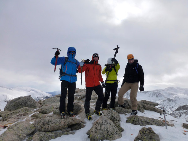
Montmalus summit conquered during a snowshoeing walk
Fast facts about Andorra
you should know before hiking there. The currency is the euro, and Catalan is the official language. Andorra is well used to tourists, so you can easily communicate in other languages such as Spanish, French and English.
To learn more about Andorra in English, click here. I don’t agree with everything on this site, but most of the information is correct. This page is better.
Andorra hiking Maps
Unfortunately, there are only two maps which cover all Andorra. Their scale is 1:40000 though. A scale of 1:25000 is more suitable, but apparently that doesn’t exist.
One of the maps is produced by Editorial Alpina. Another publishing house, Editorial Piolet, has produced the other one.
Editorial Piolet also has another map scaled 1:15000, but it covers only a small part of the country.
When hiking in Andorra
From the middle of summer – see the details above for every peak. Some peaks can be walked in winter, but the paths are different. Winter walking is the subject for a separate article.
Guided or solo Andorra hiking?
It depends on your experience in high mountains. If you are not very used to walking above 2500m, you should hire a guide.
You should also have good navigation skills if you want to go solo. Some parts of the paths are marked only with cairns. Even where there are painted marks, at some places the paint has vanished.
Rest days and sightseeing
There is not much to do in Andorra if you’re not hiking, apart from shopping. If you like skiing, Andorra is full of ski resorts, but that’s another story.
Among other attractions, Ordino is a village worth a visit. It features in my blog as one of the Most Beautiful villages in the Pyrenees .
Escaldes is a village well known for its sulphurous springs where the water rises at 61°C. You can relax at the Caldea spa.
Hiking in Andorra: where to stay
I would say Andorra has the largest concentration of hotels in the Pyrenees. Hotels are full in winter, but in summer there is plenty of availability and lots of competition on price.
If you feel comfortable sleeping in a dormitory, there are four staffed mountains huts in Andorra:
⇒ Comapedrosa mountain hut (2267m). The information is only in Catalan.
⇒ Borda de Sorteny mountain hut (1969m)
⇒ Juclar mountain hut (2310m). The information is only in Catalan
⇒ Cortals de Sispony mountain hut (1660m).
⇒ L’Illa mountain hut (2230m)
There are many unstaffed mountain huts in Andorra. They can be used during very bad weather conditions. Although, I do not advise to use unstaffed mountain huts to stay overnight for several reasons which I do not want to explain here.
Getting there
You can fly either to Barcelona or Toulouse. Both are about the same distance and the same travelling time from Andorra la Vella, the capital. The journey takes about 3 hours.
You can get to Andorra by bus from Barcelona. Take a look at:
— Directbus. (Also from Barcelona airport)
From Toulouse, check out these websites:
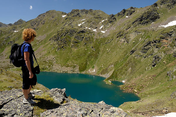
Andorra, a place to dream
Getting around
Renting a car is the cheapest option, letting you move around freely and avoid having to pay for taxis to the starting point of hikes.
There is also a local bus service, but it mostly doesn’t serve the points most interesting for hikers. More information here, though it’s only in Catalan.
Andorra hiking Guidebooks
The best are in Catalan, Spanish, and French. However, you can find useful information published by the Andorra Government here, which has details of walking tracks.
Geology in Andorra
34% of Andorra’s territory is covered by woods. But, what about the ground?
There are four kinds of rocks in Andorra:
Climate
Andorra has a cold climate because it is south oriented and the sun radiation is very low in the narrow valleys, in autumn and winter. Keep in mind that when hiking in Andorra.
Summer storms are less frequent than in other parts of the Pyrenees situated further east.
Average annual rainfall in Andorra is between 1000 and 1200 mm above 1500m, and between 800 and 900mm in the bottom of the lowest valleys.
Above 2200m precipitation falls as snow instead.
Andorra is so high that it is not affected by the mass of wet air that comes from either the Atlantic Ocean or the Mediterranean Sea.
Above 2300m the snow remains for 5 or 6 months, though 7 or 8 months on shaded slopes.
Fogs and mists in Andorra are not common, although high clouds usually cover the summits of Andorra peaks in the North of the country.
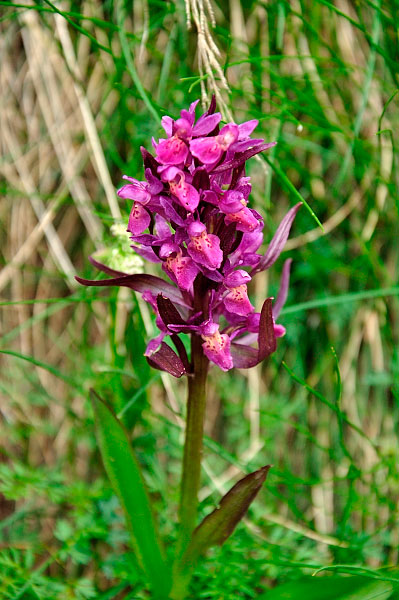
Dactylorhiza sambucina subsp. Sambucina
Wildlife in Andorra
37% of land in Andorra is meadows. 35% is occupied by conifers. You will realize after hiking in Andorra that, surprisingly, a tree that is very common in other parts of the Pyrenees is rarely found in Andorra: the beech tree.
In former days, the forges used most of the pines as timber, which were later substituted by silver birch trees.
The alpine meadows are situated between 2300 and 2400m, and are used to feed the livestock.
The conifer woods have dwarf mountain pines, scots pines and silver firs. The area occupied by these woods has decreased a lot because the pines have been abusively cut down.
The dwarf mountain pine can attain 2400m, but the woods with this kind of pine can reach only 2200m. The shrubs which accompany the dwarf mountain pine are the alpine rose, the bilberry, the Genista balansaes subsp. Europea and the common juniper.
Apart from conifers, other trees populate the Andorra mountains: the silver birch and the mountain ash.
Between 1000m and 1500m you find the deciduous trees, which have been very depleted. The most common is the oak and the scot pine. On wet soils, you find hazelnuts, common ashes and goat willows.
Regarding the fauna, the wolf and the bear disappeared in Andorra long time ago, despite the bear has been reintroduced in other parts of the Pyrenees.
You can watch chamois, although there are far less than in the Catalan Pyrenees. In September, hundreds of hunters deplete the herds of chamois, year after year.
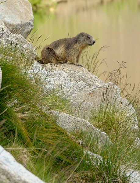
There are also foxes, squirrels, hares, rabbits and marmots. The otter is an endangered mammal though.
Regarding birds of prey, there are some eagles, vultures and falcons. Unfortunately, there are few capercaillies in Andorra.
Andorra Population
In 1944, Andorra had 5,291 inhabitants, 19,545 in 1970, 60,000 in 1991 and 70,500 in 2015.
70% of the population are Spanish, French and Portuguese.
Visit Art while hiking in Andorra
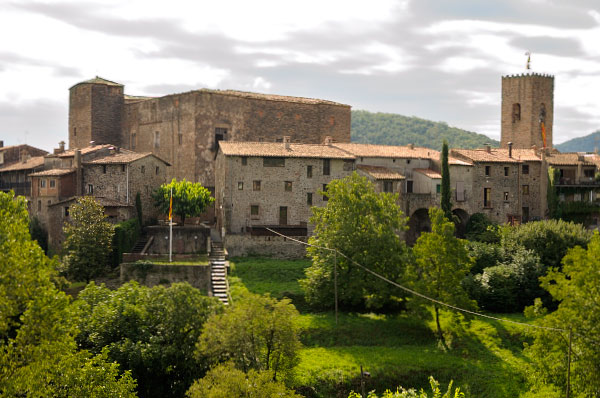
In Andorra the Romanesque art is the main one which has remained until now. The Romanesque architecture is civil, military and religious.
All the castles are in ruins except the Sant Romà de les Bons castle. Four medieval bridges remain in Andorra.
However, you can find many Romanesque churches, eleven of which have wall paintings. Talking about Romanesque churches in Andorra would require an article on its own.
Finally, some examples of Gothic and Baroque art remain in Andorra.
Please comment below on Hiking in Andorra Guide.
If you wish to travel to Andorra and see the most beautiful spots in this part of the Pyrenees – see what tours we have for you or contact us here for any Pyrenees Tours questions you might have.



Diana Sorensen
16 May, 2018 at 5:58 amIs it possible to walk from Coma Pedrosa to Pica d’estats in 1 Day ? E.g. from the lake site…
Miguel Ibáñez
18 May, 2018 at 9:23 amThanks for your question.
It is not advisable Diana, as I messaged you by Facebook chat.
Caitlin
12 April, 2019 at 4:29 pmHi Miguel, I am planning a hiking trip through Andorra: I want to hike from France to Spain. I have planned out my route, but I am wondering how long it might take. Do you have a possible idea?
Miguel Ibáñez
15 April, 2019 at 5:20 pmHi Caitlin
We continue in private.
Miguel
Joost
21 September, 2020 at 7:28 pmHi Miguel, we are visiting Andorra with a camper van. Preferably we do day hikes or maybe one two-day hike. Where should we stay and can we do hikes where we get back to our starting point easily? We are experienced hikers so can do 8 hour hikes if necessary. Thanks a lot!
Miguel Ibáñez
22 September, 2020 at 3:55 pmHi Joost.
Unfortunately I cannot help you with places for camper vans. I take my customers to hotels and staffed mountain huts.
Anyway, take a look here: https://visitandorra.com/en/sleeping/campgrounds-in-andorra/
Good luck!
Kind regards
Miguel
Samantha Schultz
13 March, 2023 at 10:50 pmHi Miguel,
Do you personally provided guided hikes or do you have guides that you would recommend for a day hiking trip?
Miguel Ibáñez
14 March, 2023 at 9:41 amHi Samantha
Thanks for your message.
Both, I personally provide guided tours in Andorra, but for one day hike it is one of my guides who guides you.
I do not live in Andorra so I go there for 3-4 day tours.
Should you have further questions, please do not hesitate to contact me at miguel@trekpyrenees.com
Kind regards